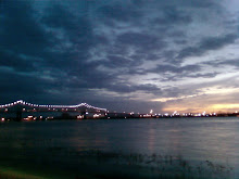
The sun sets for perhaps the final time over my neighborhood this evening before the great blow comes our way.
Presently the state is in high gear preparation mode. The governor gave another overly long press conference where he pretty much covered everything but the kitchen sink with regards to storm preparation and evacuation. Most coastal parishes (defined as all parishes south of I-10) are either under mandatory evacuation orders or will soon be - this includes the city of New Orleans which plans to start mandatory evacuations tomorrow morning. Eventually the powers that be will begin to impose curfews and traffic movement restrictions, again proving that they have not learned their lesson with regard to preserving the people's civil liberties in these crucial times.
By bus, by auto, and even by plane and train, people are fleeing the Gulf Coast like beetles crawling from a forest fire. All Interstate arteries and virtually all of the surface roads leaving New Orleans are packed solid trafficwise. (Not a comforting sight to see I-55 northbound wall to wall with traffic as I crossed over it this afternoon on still free flowing I-12 west.) To facilitate the evacuation, the contraflow for both southwest and southeast Louisiana Interstates is now planned to be activated at 4 AM on Sunday morning.
The storm itself looks to achieve a central Louisiana coastal landing at midday Monday as a Category 4 hurricane (or even Category 5, which I have not personally ruled out), and this prediction has not changed much in the past 24 hours. With this track, it would place the cities of New Orleans and Baton Rouge on the east (strong) side of the storm. The Westbank of metro New Orleans in particular appears to be under the gun with regards to flooding and surge. (This will of course finish a rare part of the city that more or less survived Katrina intact, spreading the vast wastes of tropical destruction even further afield.) Of course all areas east of the Industrial Canal (St. Bernard Parish, Lower 9th Ward, and New Orleans East) and the immediate coastal parishes are virtually guaranteed to flood severely, whether levee "protected" or not.
Folks, this could be worse than Katrina. Katrina produced only a glancing blow to the state, though even this was enough to break the levees. This storm is nearly certain to lay waste to a vast and large swath of the state, from Lake Charles to Slidell. And there is no question that if the effects are as bad as Katrina or worse, it will absolutely convince corporate America that Louisiana is simply no longer a viable place to do business - any type of business. Expect massive business disinvestment and large scale economic destitution for those who remain here in the aftermath of this storm.
It remains to see whether there will be an economy, or much of anything else, left in Louisiana after this gigantic event. My long hiatus from major life disasters would appear to be coming to an end. It is only the fact that BR is so far inland, and thus relatively innured from natural disasters, which provides my only hope that I will not be scrounging for economic survival, along with around half a million other people, in a week's time.
As dey say, folks, stay tuned to this blog for further storm reports. To paraphrase Jimmy Buffett, come Monday it will be far from alright.
The Capital City looks to see a vast impact from this storm even while situated relatively inland, and as long as I have electricity, this blog stands prepared as an information source for those who revel in our further destitution.


No comments:
Post a Comment