One fine day a while back I happened to be bipping around the central area, and during this occasion I took these photos at great risk to my life and limb from the open air observation deck of the Louisiana State Capitol:

This picture of downtown is the photo on my computer desktop background.
Sad when you can capture virtually all of the central business area in one snap...

To the east sprawls the Mid-City area (my former place of residence) and on the horizon lies the vacuous suburban wastes of eastern BR. The freeway is I-110, with the hairpin bend of the Governor's Mansion curve plainly visible. In the distance, you can see the tiny white rectangle that appears to be a building; this is the Class B-in all its glory Dean Tower, which is situated on Florida Boulevard near BR Community College.
My current home lies somewhere in this photo. Can you guess where?

The industrial/petrochemical precinct of the northland is situated not too far from here, its complex metal sarcophagus and omnipresent steam cloud constantly looming over the city. Some forlorn State buildings located along the Capitol lake occupy the foreground.


On a clear day (and many not so clear ones) you can see Fart Allen and the vast Sugarcane Empire of the westside rolling off toward the western horizon.

Penetrating toward the forbidden southeast suburbs, the camera lens strains to distinguish anything of merit within the sea of heavily foliated urban sprawl.

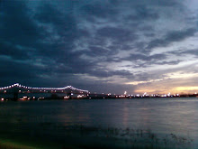
The mighty Mississippi rolls past the Capital City and its teeming industries, as the "old river bridge" (US 190) provides a backdrop in the distance.


No comments:
Post a Comment